Saturday, December 31, 2011

Dec 23-25 St. Thomas

Third post of the December cruise:
On Friday 12/23, with the wind still occasionally whistling in the rigging, we opted to enjoy a second night at Crown Bay Marina. The place was half empty since few boats were moving in those conditions. In the afternoon we took a ten minute ferry ride over to Water Island, took a short hike up a hill and down a hill, and arrived at a postcard perfect spot called Flamingo Bay. It is a very quiet and protected bay on the leeward side of Water Island with moorings and plenty of room to anchor; we’ll be back with Heron some day. We enjoyed an afternoon of snorkeling and eating at the beach grill with friendly folks from the UK who arrived by catamaran from the Queen Mary 2 cruise ship docked at Crown Bay . The seven of us were now chillin’ to the max, getting more and more reluctant to move anywhere.

On Saturday 12/24, conditions had eased so we were off to nearby Christmas Cove for more snorkeling. After a low-speed tour of Charlotte Amalie, we cranked up the engine to 2000 rpm to power into the wind and current along the south coast of St. Thomas.  But wait...  the stuffing box started spraying sea water all over the engine compartment. Here we go again. Arrrrgh. In our new adrenal-avoidant state, we just held 1700 rpm to keep it dry and watched the coast drift by at a sluggish 4.5 knots. We’ll adjust it later, mon. Island time.  Limping into the cove, we picked up a very protected mooring next to the prime snorkeling spot and got into the water. Wow. The variety of fish was amazing. This is what we came for, and this is the memory we will take home with us. Christmas Eve in Christmas Cove. Catchy, eh?! We did our Hanukkah menorah lighting ceremony and listened to reggae christmas tunes on the local radio station. Bizzah. Wicked bizzah. Jamie put together a yankee swap that had everyone laughing, taunting and playing Bananagrams. The beer was cold. Life is good.

Aside on stuffing box adjustment: We later found that our guardian angel mechanic had set the s.s. collar to compress the bellow only 1/8” from the neutral position. After talking with both PYI and New England Boatworks and downloading the instructions from the web (isn’t modern communications wonderful), we set it to 1” per the manufacturer’s specifications.  So far this setting has worked perfectly at all rpm.

On Sunday 12/25, we were challenged to make a decision. Should we jump back into the water or sail over to Francis Bay on StT? We swam, analyzed, agonized and swam some more until mid-afternoon when it was clear that we weren’t going anywhere. At least 70 boats of all kinds—power, sail, monohull, multihull, dinghies and huge yachts-- arrived from StT and formed two huge rafts between Heron and the beach. The place was rockin’ with great audio and the drinks were flowin’. A fine bikini-clad specimen wearing boots and a flowing red santa hat was water skiing amongst the boats. People swam, kayaked, dove and danced. One sailboat had folks halyard diving --where someone holds onto the middle of a very long line that is attached to the masthead on one end, and a fast dinghy on the other end; when the dinghy speeds away from the sailboat, the line straightens out and lifts the person high up and away from the boat, where they let go and dive into the water to the cheers of the adoring crowd.  Evidently this tradition is repeated every Christmas Day. By sunset, tropical peace and quiet once again reigned over the cove.

Friday, December 30, 2011

Dec 21-22 St. Thomas

Second Post on December Cruise:
On Wednesday 12/21, after a sleepless night, Emily and I left Coral Harbor for Christmas Cove and then moved on to Charlotte Amalie. Coral Harbor was an overcrowded anchorage, with all boats on anchors with different scope and dubious tackle, and with very strong gusts from almost every direction and noone watching.  It would have been imprudent to go ashore with noone aboard.  See ya. Got to go. We were just glad that our anchor wasn’t below another boat when it came time for us to boogie.

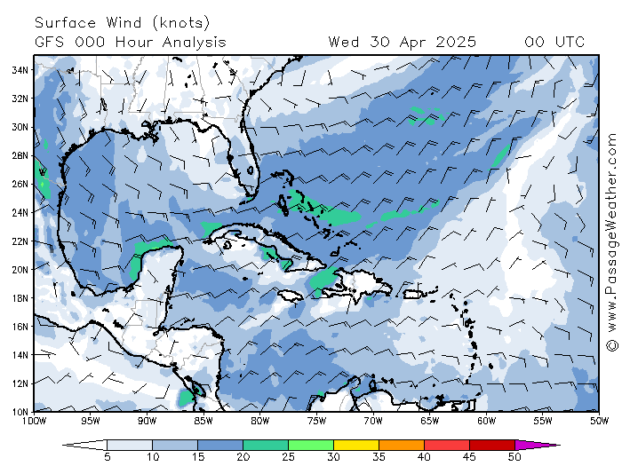
With just the jib, we ran back down the south coast of St. John, passing all the wonderful anchorages that we plan to come back to some day. Saltpond Bay is reported to be wonderful, with hikes up the hills.  We stopped for lunch at Christmas Cove on Great St. James Island, but the place was packed with boats and so had to anchor out. With the strong Christmas Winds and northerly swell, it was an uncharacteristically nasty place. So we moved on to gain the protection of Charlotte Amalie, the capital of St. Thomas and the home of ginormous cruise ships. True –Charlotte Amalie is surrounded by land and there is plenty of room to anchor –but the wind was blasting over 40 knots at times, making it exciting to walk up up to the bow to check the anchor, which held well. The sea was 80F, the air was 85F. When a strong breeze blew, it was still warm. What a strange place. I knew I wasn’t in Kansas any more when the Disney cruise ship left the dock, blowing its horn to the tune of “When You Wish Upon A Star”. Ohhhh-Kayyyy.

Aside about anchoring: In 18’ of water, I put out the 55 lb. delta plus100 ft. of 3/8” chain plus another 10’ of the 250’ of 5/8” megaplait self-flaking braid that is attached to the chain, plus a 35’ 5/8” 3-strand chain snubber. This primary ground tackle is used by Scott Piper, J/160 Pipe Dream, now on his fifth circumnavigation. When rarely needed, he puts a second anchor in tandem with the first, separated by 10’ of chain. That’s my plan too. The Vesper AIS has a fantastic anchor watch on its display that consumes almost no power (a few hundred milliamps as I recall). It beeps me awake when the boat moves out of a circle of a configurable radius centered on the anchor; I use 110 ft. In the past I used the anchor watch on my Raymarine RL80CRC chartplotter with the Raymarine GPS on Seatalk. This works great but this combination consumes something like 5-6 amps –way too much. I’ve n-e-v-e-r d-r-a-g-g-e-d with Heron, but there will be a first time.

On Thursday 12/22, Emily and I awoke in Charlotte Amalie to continued strong winds. It was the beginning of a day that would deplete our adrenal glands. My daughter Julia (12), my brother Andrew and my sister-in-law Jamie, and their two daughters Leigh (16) and Kelsey (15), were scheduled to fly in to join Heron for our remaining week of vacation from the cold.  Four teenage girls together on a boat for a week should spell trouble. But these girls have been thriving together on boats for many years, not only making it easier on parents, but providing one of the biggest reasons that we go boating.  Crown Bay Marina offers a short five minute ride from the airport, a high quality market to provision the boat, fresh water, shore power, and Tickles –an open air restaurant that offers great food, drink and atmosphere. So that's where we were headed.  The only problem is, it’s a total bitch to get into a slip there when the wind is howling. It’s so tight in any condition that you have to get cleared in and out by their traffic controller.

Scene one: We waited until 11 am, when the dive boat captain said the wind was expected to ease. We called ahead and changed to a leeward slip assignment and lined up some dock hands to help us. We set our lines and fenders and rehearsed diagrams on paper as to how we would enter, back in, and secure the boat. I had an extra cup of coffee. But it still howled. As we entered the marina, the wind was still in the mid-20s with stronger gusts. After two power-on attempts to line up on the slip, with the bow anchor poised dangerously at the belly of a 120’ power yacht, I bailed. In reverse, my 3-blad Maxprop pulls the stern to port, rotating the bow to starboard --the same direction the wind was pushing it --not in the direction we wanted. I didn’t have enough room to gain way for the rudder to do it’s job. Ain’t got no shtinkin bow thruster on this performance cruiser... but I sure wish I had one this time.

Scene two: Back out into Crown Bay, our plan is to collect ourselves by picking up a mooring (any mooring) until the wind abates. The plane lands in an hour, but they’ll have to suffer at Tickles until we’re ready for a second landing. It’s blowing so hard, Emily and I have to punt on our first attempt to pick up a mooring. We land on a second mooring with a pulse rate that I don’t get to in the gym. A very nice guy with a santa beard passes by on his dinghy saying that we’re on a very strong mooring and they probably won’t be back for a few days, and that we should call him on VHF66 if we need anything. I’m feeling relieved. When I come back to the cockpit, Emily casually mentions that “The water tanks are making a funny noise.” That’s weird. When I go below, I hear the electric bilge pump running and the distinctly horrifying sound of rushing water. Bing. The adrenalin pump goes to full max. Floor board up; water 4” below the floor; engine compartment door open; stuffing box flooding; towel wrapped on stuffing box; Emily manning one manual bilge pump; I pump the other. Holy kripes. We’re sinking. I get on VHF66.  Santa says he’ll be right over, but advises us to call a towing company as they carry pumps. With a pump handle in one hand and the cellphone in the other, I called Tow Boat US (per my subscription). After reporting my position and situation to the dispatcher (somewhere in the US), he replied that they don’t have any facilities in the Virgin Islands. Not good. Meanwhile, there is now a dinghy arriving to my stern with another a few minutes away. I thank the dispatcher and hang up. Approaching the fellow in the dinghy, I get an earful about how I’m on his mooring and that his boat will be returning..... blah blah blah... to which I responded that “I’m sinking and sure could use your help if you are willing to come aboard.” His affect flipped 180 degrees.  He was a professional boat mechanic and knew exactly what to do!  Dinghy two arrived with santa from VHF66, who was a friend of the first guy, so we were ready to party.

Within 5 minutes, the leak was stopped. He jumped into his RIB and ran off to the chandlery at Cruz Bay Marina to buy parts to improve the design, returned to install them, and departed with a heavy tip and a few bottles of my good wine. He was a guardian angel, arriving within minutes of the crisis. If he hadn’t arrived at that time, it would have taken me seemingly forever to calm down enough to repair it.  Emily is always calm and would have been the tool gopher, but I was a wreck.  It turns out he was a retired long-line fisherman out of New Bedford then Boston, fishing on the Grand Banks and Flemish Cap –perfect storm territory. He (who’s name I can’t recall) also spent time with Linda Greenlaw and passed hydraulic fluid to the Andrea Gail, the ill-fated ship in the book. We must be in some kind of movie.  Anyway, somewhere along this timeline I’m hearing the US Coast Guard out of San Juan Puerto Rico repeatedly calling a vessel that sounds like Heron.... Highreon or something. After a classically repetitive conversation, they get the idea that I’m the guy they are looking for and that we are no longer in danger.   Tow Boat US had notified the coast guard of my position and my identity, using information from my subscription. Later I found voicemail messages on my cellphone from both Boat US and from the USCG San Juan –which I returned and closed their incident reports. Whew. It’s a good thing I didn’t hit the SOS button on the SPOT, or the GPIRBs, or call mayday on the VHF or SSB, or call 911 on the cellphone, or....

Aside on the stuffing box failure: The stuffing box is a PSS (Packless Seal System) Shaftseal dripless stuffing box from PYI. It was completely replaced for purely preventative reasons by New England Boatworks at my request, 10 months ago, in preparation for this trip. It worked flawlessly all summer. The old one was 10 years or 900 hours of engine use old, and looked fine. Evidently the allen head set screws that hold the new stainless steel collar to the shaft had loosened. While attempting to dock at Crown Bay, a burst of reverse probably caused water to extend the bellows and to push the s.s. collar forward on the shaft. Subsequently there was a gap between the s.s. collar and the carbon ring that is attached to the bellow and the stern tube. It’s shocking how fast the water came in. The guardian angel mechanic who fixed it has installed several on his boats, but now prefers the old fashioned packing type. But for the PSS design, he enhanced safety beyond the installation instructions in three ways: (1) replace the allen set screws with long 5/8” hex head bolts, with nuts to lock them against the s.s. collar. (2) use Loctite on the bolts. (3) put a zinc anode donut or ring on the shaft inside the boat, tightened against the s.s. steel collar. The amount the bellow is compressed beyond the “neutral” position is important, as I’ll report in a subsequent scene of this drama.

Scene three: OK. We’re not sinking, the wind is down to 13, the gang is waiting at the marina, and Emily and I are ready for more action. Our plan is to land on the marina fuel dock (infinitely easier), refuel (since we’re there), get my brother aboard (who is good at this stuff), and make another attempt to get into our slip. After kisses and hugs, we try three more attempts to back in. No go. Ain’t gonna happen. So I go in bow-first in one shot and before we know it we’re all hooked up with every last inch of our power cord. So I’ve learned something about my boat: It’s always more maneuverable in reverse –except in tight spaces where prop walk dominates over rudder flow and where pulling the stern to port defeats the plan. It’s time for dinner and drinks at Tickles followed by star gazing in the cockpit!

Jay

Dec 18-20 in St. John

We’ve had a fantastic ten day cruise in the US Virgin Islands with my girls and my brother Andrew’s family. Here’s the play-by-play of the first few days:

My daughter Emily (16) and I arrived on Sunday 12/18 by non-stop flight from cold Boston to glorious St. Thomas (StT). I’m still amazed that you only have to stand a single 4-5 hour watch to jet above an eleven day sail. We took a taxi ride over the mountain to Red Hook, a ferry ride to Cruz Bay, St. John (StJ), a taxi ride to Great Cruz Landing on Great Cruz Bay (GCB), and finally a dinghy ride to Heron on her mooring. The journey was easy, but the intricacy of it made the arrival all that more exotic –like going up the river in Joseph Conrad’s “Heart of Darkness” or in Ford Coppola’s “Apocalypse Now”—only different. We kicked back in the evening light, happy to simply take it all in. Ahhh.
 Heron was an especially welcoming sight since the Proper Yachts team who takes care of Heron in GCB (Steve, Ashley and Veronica?) had already put some food aboard, cooled down the icebox, opened up the boat, and had put up the bimini and the ensign. They had also re-done the varnish work, polished the stainless and the gelcoat and had cleaned everything to Bristol condition! Despite having to patch several years of poor varnish work, they had produced a surface on the teak toerails that looks as if it was sprayed on -- the best since the boat was new. I shouldn’t be so surprised since I counted at least seven big Hinkleys in the harbor under their care. It is true in my case that a sailor’s mood can be predicted by the status of their boat’s bright work.

On Monday 12/19, Emily and I had brunch on the beach at the Westin Hotel on GCB. It was an indulgence of overeating in a stereotypical beach resort setting—just what we needed. After recovering from the carbo crash, we took Heron out for a sail along the south coast of StJ to Ram Head and back. We close-reached out and broad-reached back in NE18. The mountain tops of St. Croix were visible above the horizon 30nm to the south. I called my in-laws Sam and Shirley, who spend winters on StX, that their island was still there. The uninhabited green slopes of StJ dropped steeply to the turquoise ocean—the opposite of our own beautiful Buzzards Bay marshes and slate gray water! The sea was 80F; the air was 85F. It was still warm when the breeze picked up or when gusts blew down from the hillsides. Ya gutta luv de tropics.

On Tuesday 12/20, we retraced our steps to the SE corner of StJ, headed for Coral Bay. Under full sail, beating into 23-30 apparent and an ocean swell, the two of us were “in our glory”. At one point we crossed tacks with a gorgeous red Hinkley 50-something. The contrast was notable: Heron was under full sail (#3 jib and main) hard on the wind without dipping the rail, two people aboard in tee shirts, shorts and sandals and big smiles. The Hinkley was under deeply rolled main and staysail, rail under, five solemn folks in full foul weather gear in the cockpit, headed for Saltpond Bay in the lee of Ram Head. I know, I know; it’s just cruising and I’m being a jerk. But any two boats on the same water at the same time define a race... We dipped their stern in salute. I later learned that they are mooring-neighbors in GCB, where Heron is surrounded by a flock of gorgeous Hinkleys.

The wind continued to honk down Sir Francis Drake Channel as we tacked close aboard Leduck Island into Coral Bay. We screamed off onto a reach into Hurricane Hole and dropped the sails. Not a single house or boat was within sight; this part of the island is in the national park and probably appears as it did 300 years ago when slave traders and pirate ships lurked in this bay. Having nothing but Trader Joe’s canned goods aboard (good stuff, but it gets tiring), we motored around the corner to Coral Harbor. What an odd place it is!

Each harbor has its own boating sub-culture. You can usually tell by the type of boat and how it is equipped and maintained. This could be the subject of an entertaining book. The BVIs are loaded with charter boats from the Moorings charter base in Tortola. Many of them motor from beach bar to beach bar and enjoy a week-long party—honestly. The woman seated in front of us on our return flight recounted her sailing vacation as the sequence of beach bars they visited: Foxey’s, Willie T’s, etc,. etc. Some families do have fabulous charter vacations, snorkeling and hiking throughout the BVIs. Since it’s rare that a week-long charterer will go through the trouble of checking in/out through customs to go between the US and British islands (and they are all equally beautiful), the USVIs have far fewer charterers, and have more cruisers and live-aboards. Cruisers (like me) are mostly from the US east coast and spend too much time or money working on their boats. Many cruisers have jerry cans of fuel and water strapped to their deck, RIBs (Rigid hull Inflatable Boats) with big outboards on stern davitts, photovoltaic panels or windmills, etc. etc. Some of these are gorgeous voyaging yachts. Others have short waterlines that can’t reasonably carry all that stuff (without dramatically raising their wetted surface area, center of gravity and angular moment of inertia) and so wallow more than sail. I watched them hobby-horse and corkscrew down waves coming out of the Chesapeake. But the Coral Bay fleet is of a different sort. There are no charterers here and the very few cruisers stick out like the odd dog in the pack. Heron looks like an alien spaceship. Most are much shorter than elsewhere. Many of the boats there have no masts; even more have no sails. Some look like they were recycled from Katrina or another fatal storm in the late 70s. Many haven’t moved in months or years. They have barnacles growing up the topsides and just a few remaining shreds of sun-bleached canvas. I didn’t see any moorings. Except for the occasional presence of an odd rowboat on the stern, or an occasional raised hatch, there are no signs of life aboard. I’m guessing that they serve as a floating bedroom for someone who is living close to (or under) the edge. I’d like to imagine that they are an eco-friendly tuned-in peace-loving floating camp of idealists, living John Lenon’s “Imagine” or Bob Marley’s “One Love”. But I doubt it.  More to follow.
Jay

Thursday, December 1, 2011

Gone Fishin'

Hundreds of miles from the nearest anything, the VHF radio came to life:
Freestyle: “Heron Heron, this is Freestyle....We are slowing down to let you catch up. Get your cameras ready.”
Heron: “Roger.”

As we sailed up along side Freestyle, our jaws dropped and our shutters clicked. Holy &*(@#!!


That is a monster fish, an incredible animal. Jim Cody and all hands aboard had landed a 7 (foot) black marlin—almost 200 hundred pounds of sport fish. Don can tell a better story, but it dove deep, nearly ran out their line, nearly shook the reel off of the rod, and required full drag and gloved hands squeezing the line against the rod to slow it down. That fish provided sushi, grilled steaks and sandwiches for many many meals, and yet most of it came home in their luggage.

Though Heron and Freestyle were partners in this adventure, shadowing each other mile after mile, this fish caused the gloves to come off.   A few hours later:
Heron: “Freestyle, Freestyle, this is Heron.... We are slowing down to let you catch up. Get your cameras ready.”
Freestyle: “What? We didn’t see you catch anything.”
As they sailed up along side Heron, there was dead silence and searching eyes, followed by roaring laughter from both boats.

 
Now THAT's what I'm talkin' bout!  The crew of Heron had strung up their catch-of-the-day--a 7 (inch) flying fish that had landed on the deck the day before, drying in the tropical sun. True to form for a fine offshore racing machine (cough), we were proud to demonstrate our success in minimizing both weight and unsightly blood stains.

As it turned out, fishing turned out to be an exciting way to pass the time. We were happy to share Freestyle’s excitement, since we weren’t too sure what we’d do if we actually caught something. Thanks to a rig that Don had made up for us beforehand, we caught tons of seaweed and one gorgeous mahi mahi.  We were convinced that it was too small and too beautiful to keep, so we released it. Honest.  Here’s the proof:

I’m looking forward to the February and March cruise in the company of Freestyle --and their fantastic fishing gear, gas grill, soy sauce and wasabi.  We'll bring the camera and the rice.

Jay

Thursday, November 24, 2011

Perspectives on Leg 2: Hampton to St. John

I’m back. It’s Thanksgiving and I’m finally getting back to updating the blog. I was gone for only two weeks, but this transitional period gives me a nice shifted perspective on the familiar. There is a heavy frost on the grass and except for the oaks, the trees are amazingly bare and motionless. Winter gray and crisp 30F temperatures are a shocking contrast to the 85F and lush hilly surroundings I just left behind at Great Cruz Bay St. John. All the intersections are backed up with traffic here in the Boston suburbs. Cars and their drivers seem so fancy and "done up", and their driving seems so aggressive and hurried. Julia seems to have grown another inch. I'm hit with momentary nauseating waves of "land sickness" when I showered and sat in the dentist's chair. The shifted perspectives at the coming are as interesting as those at the going. They are within the personal scale of this adventure; Heron and any of the hundreds of other boats in the snowbird fleets ain't on no shtinkin’ Ernest Shackleton voyage. But Chris H., who last year did this trip for the first time on his boat last winter was wise to say that he learned a lot about himself from doing this trip --and that I should expect to as well. Time will tell. To me, it’s not about silly fiberglass vessels, or emulating eighteenth century caricatures pulling on lines, or adolescents drinking at beach bars or salty dogs puffing dock-talk bravado; it's definitely about being amazed with the present and nature—in the company of interesting friends. That’s pretty harsh, but the Jimmy Buffett icon never made my boat float. Geez Jay, just tell me about the trip! Sorry--I just had to put that context out there.


BTW my personal rule for the blog is that I will not deliberate or polish. It’s not a book. So you’ll have to suffer with colloquial stream-of-thought outbursts that can be written in under an hour without drafts or revisions. I force myself to not think ahead about what I’ll write. I try not to limit it to being a pure narrative. I’m trying on one hand to record and to share, and on the other hand to avoid dragging the actual physical experience back into the virtual intellectual notion from which it came.


It’s a vast ocean. That’s the first thing that hit me. I’ve sailed to or from Bermuda thirteen times, but this was two Bermuda trips. I knew that beforehand. Now I feel what that means. Day after day of sailing in the same wind on the same seas. Two gybes and one tack in seven days. Nothing to see except blue sky on blue water. Sunrise, sunset, sunrise, sunset, and on and on. It forced a mental shift on our perspective of time and distance. We were tiny and insignificant flotsam on an ocean dessert.


It’s spectacularly gorgeous. That’s the second thing that hit me. I was sick of hearing myself say “wow”. When there is nothing to obscure all 360 degrees of horizon--the moonrises and sets, the sunrises and sets, the meteors, the satellites, the crests of big waves in the distance, the prominence of the Milky Way, the brightness of the planets, the lines of tropical clouds along the horizon, the blue and green colors of the mahi mahi and the seven foot black marlin—were all things that took my words away. We were immersed in grand majesty, experiencing an elemental beauty.


It’s stressful. The gods were gracious to allow our quick passage through a domain that is not our natural place to be. We were visiting aliens, surviving only by virtue of our strange craft. We huddle virtually through radio nets with the fleet. We look over our shoulder continually as we monitor weather forecasts and sea state. We watch the equipment for signs of problems, and jump to repair things like leaking engine vent loops, and chaffing reef lines. We monitor fuel, water, food and battery consumption. We stand 4-on, 6-off watches with military fervor. We deal with seasickness (me), constant motion, constant noise, constant 10-20 degree heeling, cold, steamy heat, constant drinking (water), loss of appetite (some of us), constant spray on closed hatches, periodic bangs of the bow dropping onto the back side of large waves, two showers in a week, the closeness of five adults living for two weeks within about thirty feet of each other, the boredom and exhaustion of standing watch, etc.
We had a great crew:  Peter Burch, Ray Cullum, Ron Gaudet, David Risch and Jay P-A.  Imagine putting five adults together for two weeks in stressful conditions in a small space... and not getting pissy to one-another.  Imagine that depth of experience (more details later)... and not having a "multiple captain" issue, and everyone contributing in many ways.  Imagine having total confidence in all watch combinations, and a totally positive experience as we  shared some crazy funny and some amazing moments.  That's what we were very fortunate to experience. 


It’s exciting. I really can’t describe the thrill I felt when Pete called “Land Ho”, and we saw the mountain peaks of St. Thomas and St. John above the horizon. It was really something. It was all new to me. Later, when we were safely in a slip in Crown Bay Marina, just seeing Heron sitting in this strange place was just amazing. I flew the Anderson plaid burgee from the mainsheet. It was torn during a full gale coming back from Nova Scotia in 1983 and is only flown on very special occasions. It infused the boat with the spirit of my dad (OBM), Angus Anderson, who surely got a huge kick out of our adventure.


Synopsis for Heron trip from Hampton to St. John... Strong NW winds on the west side of TS Sean provided a blistering fast day-one departure from the Chesapeake as Heron gybed down the rhumb line in large steep seas. Subsiding conditions as a large stationary high built across the rhumb line led to two days of motoring in glassy calm conditions. ENE, E, ESE, E14-24 winds filled in as we exited S of the high, allowing four days of idyllic reaching conditions at 40-60 apparent wind angle under double-reefed main and 100% jib (rolled in and out to change gears). Seven days, nine hours, from Old Point Comfort to Middle Passage, roughly 1300 nm. Never more than 20 nm from the rhumb line.  48 hours of motoring, using 75 gallons of fuel.  No hard driving—just cruising. No injuries. No damage. No shortages. More details  and lots of pictures to follow.


Happy Thanksgiving,
Jay

Friday, November 18, 2011

St. John Ahoy!

Once again, as gathered and/or told to Mindy:

I spoke to a somewhat queasy Jay yesterday - no doubt the victim of some rather lumpy seas.  But, all of that will end soon, as today is the last full day of sailing.  My highly unscientific estimate says that they will be in between 8pm and midnight today.  In general, they've had decent weather, with doses of both sailing and motoring.  Indeed, a full week of adventure on the high seas, with I'm sure, stories to share.  Stay tuned, the next blog entry will be from Jay.

Tuesday, November 15, 2011

Day 5: We're back in summer clothes!

Information reported to Mindy via sat phone.  The sat phone data link is currently not working.

Heron and crew are enjoying their ride south!  Day 1 started with big wind as they blasted out of Hampton.  This was followed by a day or so of light air - light enough to require some engine time.  By midday today (Tuesday the 15th), they are roughly at the latitude of the Florida Keys and the Bahamas Vero Beach Florida.  I spoke to Peter today on the sat phone (before the communication evaporated into the ether) and he reported the change of clothing to summer garb.  So, at about the half-way mark, all is well on the high seas.

Friday, November 11, 2011

Day 1 at Sea: Finally!

Hi from Heron,
We’ve had a fantastic first day.  As you can see from the track, we left the docks at 10am, and now at 6pm, we have already sailed 70 nautical miles (log distance), for an average boat speed of 8.8 knots.  That’s crankin!  We are gybing downwind toward our intended entry point to the Gulf Stream  Our ETA at the GS is around 2 am.  We’d hoped to get there at dawn, but we are going too fast.  No problem.  The wind has already eased down from NW23-28 gusting 30, to a pretty steady 22 knots from 305M.  Our average SOG in the last 10 minutes is 8.6 knots.  We are sailing on a deep reach with single reefed main and #3 jib (100%). 
Ray is heating up the shepard’s pie in the oven, which we’ll have for dinner shortly.  Ron is at the wheel, smiling ear-to-ear.  David is off watch, asleep in his bunk. Pete is on standby, cat napping in the cockpit.  I’m getting ready for a radio net to begin, where all the boats check in and hear weather updates.  Freestyle is 4 nm behind us, in constant contact on the AIS and the VHF.  All is well aboard both boats.
We turned the heat on and now the cabin is cozy.  The motion is very comfortable in stern seas that are now in the 4 foot range, down from maybe 8 feet.   We hit 14.5 knots SOG on one wave.  It was fantastic, tracking like a train on rails.
We have made the transition from dock zombies to sailors, and we are very happy.  Talk to you later.

Thursday, November 10, 2011

do you have intrnet srvis.

Greetings elementary school kids at the Summit Montessori in Framingham MA.  Miss Jean (my sister) sent me your great questions.  Thank you.  I'll try to answer some of them for you.  But first, here is an update:  The nasty tropical storm named Sean that is passing up the coast still might become a baby hurricane, but it is way out to sea and won't affect us (hopefully) after tomorrow.  So we are finally leaving the docks tomorrow morning in the company of 85 to 100 boats.  Yay!!  Even more awesome, the boats that we know that were in it have made it to where things are getting better for them.


*  do you have intrnet srvis.  (Bella, 1st grade)
Only when we are close to land and can receive the cell phone (3G and 4G) signals.  After that we depend on satellites and radios that can send and receive very short emails--but that are way too slow to surf the web.  More than 30 years ago, before your time when internet technology was very new, people used modems attached to their phones to connect.  That's similar to what I have on the boat now --9600 bits per second.  That's maybe 1000 times slower than what you have at home today!!


*   Are there pirates in the Bermuda Triangle? Have you seen the ghost of John? Do water cannons on your boat? Have you eve sunken a ship?  (Zane, 3rd grade)
*  Have you ever seen a pirate ship at sea and if you did did you sale away. Have you seen the goust of John. (Nik, 3rd grade)
Arrrrgh.  Shiver me timbers.  We can watch the pirate movies on the computer, but no, there are no pirates where we are going.  Sometimes we fire water balloons at my brother's boat (for fun).  There are far off places in the world where pirates (without parrots and eye patches) steal a boat and ransom the crew.  But we are staying far far away from those places.  Isn't Johnny Depp just the coolest movie dude?!  Now days, sailors report all incidents (like burglary and theft) to a website so that other sailors can know where it is safe to go, and so the police in those places will try harder to make those places safe.  Check it out:
http://www.safetyandsecuritynet.com/

*  What if you run out of gas and there is no wind. How long did it take to get to Virginia. (Nik, 3rd grade)
If we run out of fuel and there is no wind, we read books and wait.  But we carry enough fuel to motor for four or more days.  We will probably use most of it, since we don't have too much time to wait and since the forecast has a few days of light winds.  It took us 2 days and 2 hours to get from Massachusetts to Virginia.   We did not stop at night but kept going the entire time.

*  Why are boats called her  (Elijah, 3rd grade)
Good question.  That would be a good question to research on the web and report back.  Heron (our boat) is definitely a female.  Maybe it's because the sailors who called their boats "her" were men.  Maybe they missed their wives after spending so long at sea.  I do too.

*      Do you get sea sick? Waer do you get the big blocks of ice?  (Zinna)
Sometimes I do get sea sick.   It takes a while to get used to the motion of a boat.  Sometimes I take medication (transderm scopalomine or ginger or Relief Bands).  But sometimes I just feel like I want to throw up for a few hours.  We can buy big bags of ice cubes from the dock.  But we have a small freezer and a refrigerator that runs off of the engine or the generator.   It keeps our food nice and cold.

*  Is it true that the Bermuda Triangle is dangers? Do you know the storm’s name? Sincerely, Kevin. (3rd grade)
The Bermuda Triangle can be dangerous when big storms form.  Sean, the tropical storm that is moving out of our way, is an example of how the warm water can quickly energize weak storms into big storms.  Ask Miss Jean to tell you about the Gulf Stream.  That's like a river of water in the ocean.  When strong winds blow against that river, the waves get very very big and steep.  I'd rather meet an alien from a UFO than one of those walls of water.  Seriously, I don't worry about UFOs.

*  Have you seen dolphins? How big are ice brgs. If you run out of food do you go fishing? What happins if you run out of gas? Is the Bermuda Triangle scarry? Have you seen a World Pool what do you do if a stom comes in. how long is yore bote Love Hannah (2nd grade)
Wow, Hannah.  You are really thinking of some good questions.  We have seen many dolphins.  They are beautiful and love to play with the boat.  Maybe we can post some pictures soon.  We have never seen icebergs.  They don't come this far south since the water is so warm, they would melt before they get this far south.   We are carrying a fishing line for the very first time.  We'll try to catch a big fish and eat sushi!  The Bermuda Triangle is really only scary on those scary television shows.  I've never seen a whorlpool.  We've seen a water spout on the way to Bermuda, so we went in the opposite directions.  Our boat is 53 feet long--about the same length as one of the big trucks on the highway.

*  How does it look inside Heron? Where do you store your food?? Does Heron have electric or ordinary engine? ( Bence, 2nd grade)
Such good questions!  I'll post some pictures of the inside.  It's much smaller than your living room.  We store food in cabinets that are everywhere in the boat.  Five people eat a huge amount of food in a week or two.  Heron has an ordinary diesel engine.  Someday more boats will have electric engines with big banks of batteries and photovoltaic panels to charge them.

*  How many places have you sailed to around the world? How many years have you been sailing????? (Nate, 3rd grade)
I have been sailing all my life.  You can tell that I like it very much.  I have not sailed around the world, but I have sailed in many places from Canada to the British Virgin Islands.  Check out Tortola on Google Earth.  It's awesome.  The two people on the boat next to us in the marina are headed there too.  They have a beautiful new boat, which they bought because they were looking for a new adventure after having raised horses in Montana.  Sailing is full of very interesting people and that is a big reason why I like it.

*  How are you fealling? And how is the wether?  (Elwyn, 1st grade)
Thank you for asking.  I am feeling much better now that we have a good forecast to go to sea.  I am very excited because this is the very first time that I've done such a trip, the boat is in ready to go, and the people I am with are totally awesome.  So although the weather right now is cold and windy and it might rain, tomorrow we will have good weather and we will all be very very happy.

So thank you for your questions and for watching our progress.
Jay

Tuesday, November 8, 2011

Weather Along the Way

Once we finally can get going (probably Thursday late morning), we won't have internet.  So we'll be calling Mindy to give us forecasts and observations from the wind and sea state at NOAA buoys along the way.  (We'll also have SSB and VHF radios for voice and FAX and NAVTEX forecasts.) 


Here are the buoys.  This is real stuff, so this content might be inappropriate for queasy stomachs.  For example, right now SE of Bermuda, the wind is NE27 gusting 33 (not bad), with 16 foot seas with a period of only 7.6 seconds (barf city).  It was worse last night.


Virginia Beach:
SE of Bermuda:
NE Bahamas:
Atlantic South, way out to the S of Bermuda.
E Bahamas:
SW Atlantic, just N of the Virgin Islands
Here are the forecasts we'll be looking at:
Passage Weather:
NWS Text forecasts:
Bermuda Harbor Radio:
National Hurricane Center:
Graphical forecast for Hatteras:


Enjoy.

SEAN

That's all we need to say. 


It became a named Tropical Storm (TS) overnight.  We're anxiously thinking about the boats that are approaching it.  We hope they are heading W toward Charleston or Jacksonville.

Our best hope is to leave on Thursday in NW winds.  Meanwhile, back at the ranch, the inmates are getting restless.  What a gang.  More on that coming up...

Monday, November 7, 2011

Standing By To Stand By

Heron will be staying on the dock today, Monday Nov 7.  We are delaying our planned departure from Hampton to St. John. The low sitting on our rhumb line (RL) is being watched to see if will "go tropical". Last night the NHC put a 20% probability on it. Not good. This morning they put a 30% prob. on it --a "moderate" liklihood. Even less good. They are now seeing some thunderstorm development in it. The GFC model looks fine. But it isn't prudent to head into that kind of risk, to encounter a possible TD or TS three days out to sea.

The C1500 has just this morning delayed their start until Wednesday noon. Some of the Salty Dogs are waiting. Some of them are already out there.
The forecasters are saying that we "certainly do not recommend leaving today given the uncertainty of the low becoming tropical. There is much more to report what we've heard that would mitigate concern: it would only have some tropical characteristics, it would take a few days to develop, it wouldn't be very severe (maybe 30-40 kn).

Meanwhile, we'll do laundry, visit the Maritime Museum and calm down.

Sunday, November 6, 2011

T-? Days (sigh)

Heron and Freestyle are side-by-side at the Bluewater Marina docks in Hampton, all provisioned to the gills, all crew aboard, and all chomping at the bit to depart.  We are tentatively going at noon tomorrow (Monday).  But I have whiplash from the past many days of weather updates.

Roughly 120 boats here in Hampton are going through the same angst:  Sixty-five boats from the Caribbean 1500 rally are scheduled to go tomorrow (Monday).  Ten boats from the Salty Dog group left this afternoon and another 10-20 are waiting for a day or two.  Those boats have already waited an entire week here for a good weather window.  You can see it in their faces.  Grrrrr.  The "Canadian Navy" is a flotilla of cruisers who are here too.  Several "independents", including Heron and Freestyle are also processing weather from multiple sources.  So there you have it.  Total chaos.

I'd have to write a book to describe how the weather forecasts have evolved.  Here is a taste:  We arrived Friday night to Hampton by plane in 30+ knots of freezing cold wind.  The barometer screamed upwards to a crazy high of 1030mb, peaking at noon today, now in a clear warm(er) breeze.  We are now on the southern edge of a massive high (lying generally E/W at the lattitude of Delaware Bay) that is thankfully extending farther south than the models had forecast just a few days ago.  It has a steep pressure gradient descending SE along our RL to a low pressure system that is stalled at sea about 400nm east of the Bahamas.  That low is the problem.  It has been blocked from zipping up the coast by the massive high and it's pissed.  It's been sitting out there cranking day-after-day of very strong NE winds against the notorious NE-flowing Gulf Stream (GS).  The seas are observed to be over 20 feet in one region SE of the stream (29N, 72.5W).  The NOAA buoy off of Diamond Shoals is "not reporting".

We need to spend 6-10 hours busting across a very messy GS (ENE20-30, seas 10-14 ft) starting about 18 hours after departing this nice comfy dock.  Not fun. Then what happens?  It depends.  If the low continues to weeken and drifts back W towards the coast, we'd be in fat city by Thursday.  That's what was predicted before noon today, after having improved every day for the past three days. But suddenly... as of this evening... the NHC is now saying that there is a 20% chance of the low developing into a tropical somethingorother.  You can imagine the bar talk at the restaurant here at the marina.  Sheeeeit.  To quote one seasoned veteran, "I'm going to wait and see.  I don't like it when my forecaster (Parker) starts talking about favorable and unfavorable quadrants."

So there you have it.  At 0600 we talk to our weather service.  At 1000 we check in to a SSB net that will include reports from the ten boats who left and will then be in the Gulf Stream.  At noon the C1500 fleet will depart (theoretically).  At noon we'll either take wing with the flock, or become tourists in Hampton until the next day.  Not analysis paralysis, just whiplash paralysis.

Jay

Monday, October 31, 2011

T-6 Days and Counting

The National Hurricane Center reports that all is quiet in the tropics.  Whew! The GFS model shown on Passageweather is forecasting out as far as Tuesday Nov 8.  At this distance in time, the forecast supports the scenarios for departing Hampton to St. John that Don and I are planning on:
  • Plan A: Depart when ready around 1500 on Sunday. ETA at stream, 1100 Monday.   ETA at stream exit, 1700 Monday.  (Assuming only 7 knots, that's 20 hrs to the stream and 6 hrs across.)
  • Plan B: Depart around 1000 on Monday. ETA at stream, 0600 Tuesday. ETA at stream exit, noon on Tuesday.
Check out the Gulf Stream tab on the Newport-Bermuda page on that site.
 
Right now the stream is 43 nm across (if we can head perpendicular to it), and it is about 30nm from Hatteras. If we can sail a course 10-15 degrees higher (more easterly) than the rhumb line (RL) of 161M, we can pick up the favorable southerly flow of the cold eddy (CE) centered at 34N 72W.  That will depend on the wind. If it will be as light as forecast, we’ll probably go right down the beach (along the RL), then head E of the RL to cross the stream and jump on the western edge of the CE. Seas are likely to be quite lumpy with NE15 winds opposing the stream.  The model is predicting 2 meter seas left over from the storm that will “bomb” (the term used by NWS meteorologis on that low) off of Hatteras tomorrow, Tuesday Nov 1.
 
But we expect all this to change.  But that's how we think during the approach to departure.  Because we are itchy.

Saturday, October 29, 2011

Trick or Treat or Nor'easter?

Wow.  It's not even Halloween and we're expecting 5-9" of snow tonight in the Boston burbs.  Cody and I sure are glad our boats are already in Hampton.  We planned that, of course.  8+) The North Atlantic Rally for Cruisers (NARC) is scheduled to depart Newport for Tortola on Sunday.  As Don said, "I don't think so."


I'm stuck on the weather because it is so impressive and strange (to me).  Hurricane Rita fizzled off the Yucatan.  But tonight this coastal storm will "pop" just south of Long Island, generating a region of 50+ knot winds that will clip Montauk, Block Island, the Vineyard, etc.  One graphic showed a forecast for 70 mph gusts on Cape Cod.  Looking at the surface analysis charts from Bermuda, one day it was nothing;  the next day it was a bomb --just like a December pattern.. in October.  Trick or treat?! 

The next low in the parade is forecast to bring 45-50 knot winds just outside of the Chesapeake on Tuesday.  Wind and seas are forecast to diminish to light and variable by next Saturday as high pressure moves off of Hatteras.  If so, we'll be departing Hampton at dawn on Monday with the motor on in light southerly winds.  But at over a week away, that's just speculation.  We'll be watching the timing of the coastal lows as the week goes by, hoping we get lucky with a Monday departure that will ride the northerlies that immediately follow the passage of a low to our east.

Aside:  At sea, such winds are not a big problem for a seasoned crew on a well-found boat--unless they persist for days.  If they blast right on by, things get lumpy--even awesome--but not dangerous.  If something like this stalls and you are in it, the seas have a chance to build to truly time-to-pray conditions.  (On a return delivery from the Caribbean, the 67' voyaging yacht "Illusion" from Marion was abandoned and later recovered from a beach in the Carolinas.  In the same storm that stalled and that according to the USCG, generated 50' seas, a 62' Little Harbor vanished with all hands.)  This should be avoidable given attentive weather routing and conservative seamanship. Easy for me to say.

On October 30, 2005, Don, Pete and I experienced snow squalls as we sailed Heron south under the Brooklyn Bridge, going in-shore of a passing coastal low. In 2006 I started south a week earlier. It was bitter cold and windy when we spent our first night in Block Island. In 2009 I started south yet another week earlier. We had cold rain and strong winds as we screamed by Annapolis. Yee ha! The bridges were closed to truck traffic. So this year (2011), we left another week earlier--on October 9th, and had marvelous weather. That is why we get to sit here in a warm home and watch this Nor'easter (and the next) pass us by.

Meanwhile, I'd better fire up the snow blower.  Huh?

P.S.  I sure hope that Pinnacle and Another Adventure are gleefully enjoying their passage down the ICW south of Norfolk in nice weather!!

Monday, October 24, 2011

Rina Rina Go Away

With two weeks to go, the only weather worth watching is the National Hurricane Center:
http://www.nhc.noaa.gov/index.shtml
Tropical Storm Rina has just developed.  The good news about her is that the NHC and many great meteorologists will be watching her.  I really like Jeff Masters' blog site:
http://www.wunderground.com/blog/JeffMasters/


November is the transition time between the hurricane season and the season of winter gales.  Oh joy.  Choose your poison.  Since hurricane tracks are monitored and predicted so well, and since you don't go out there when one is lurking anywhere in the region, I'll take earlier (late October) over later (late November/December).  Of course nasty Caribbean hurricanes can still wreak havoc well into November--but we know where they are for many days in advance.  By mid November (sometimes mid October), it is typical to see a parade of intense low pressure areas pop off the coast near Hatteras and stir nasty conditions.  Having directly experienced this in three prior late October trips to Virginia, that's why I sailed Heron to Hampton in gorgeous early October conditions.  Finding a weather window to cross this parade of Mack- truck lows can be very unsettling.  Encountering them can break ribs, blow in ports and tatter sails.  (Just ask some of my friends.)  The insurance companies, in their armchair wisdom, bottle up the fleets in east-coast ports until after November 1.  IMHO, they should require their insured boats to hire a weather router (cheap insurance regardless) and allow them to leave when they want to, possibly no earlier than October 1.  Some of my heartier friends who annually sail non-stop from Buzzards Bay to the BVIs in December might disagree.  The boat can surely take a beating, but I am way too old for bungee jumping with the boys.


When we get within about T-10 days, I'll start watching Passage Weather, which is a slick on-line way to animate the GFS and the shorter range NAM weather models:
http://www.passageweather.com/index.htm?http%3A//www.passageweather.com/maps/bermuda/mappage.htm


http://www.passageweather.com/index.htm?http%3A//www.passageweather.com/maps/bermuda/mappage.htm


I'll get tuned in to how the major weather systems are moving by looking at the surface analysis sites:
http://www.weather.bm/charts.asp
http://weather.noaa.gov/fax/marsh.shtml#SFC


I download the grib version of the GFS model and animate it forward in time using Raymarine RNS software.  This is the same as what you see on Passage Weather. When the departure date approaches, to see an example of a wind-based optimal route, I run the optimal routing tool using the rhumb line route, the polar performance data for Heron (that predicts boat speed for different wind angles and wind speeds), and this GFS grib model (that gives wind speed and direction along the route for the next 7 days or so).  As in the Marion-Bermuda Race, I'd never strictly follow a route that is purely based on weather and boat models.  However it is nice to have a silent virtual navigator looking over your shoulder to suggest how to set up the course to take advantage of predicted future changes.  It's fun to animate optimal routes while you are waiting for the real thing.  When the sails go up, it's time to sail the boat and put the games away.


It's fun to look at the various Gulf Stream websites:
http://www.passageweather.com/maps/bermuda/ncom/000.png
http://rads.tudelft.nl/gulfstream/
http://marine.rutgers.edu/cool/sat_data/?product=sst&region=gulfstream&nothumbs=0


We will inevitably cross the Gulf Stream somewhere off of Hatteras, a NE-flowing  river maybe 30-50 nm across.  We'll cross it as quickly as possible, hopefully headed SE.  If there is a significant eddy south of the stream (a large rotating region of surface water that is colder than its surrounding warm Sargasso Sea water), then we'll consider avoiding the unfavorable semi-circle.  This isn't a race, so the consideration is really about making good time while avoiding nasty seas.  For example, if we are surfing downwind in 30 knots of wind, it wouldn't be a good thing to wander into head-currents from an eddy that are flowing against that wind.  Such seas are very steep and irregular --not fun.  But the chances of this are slight since we'd only be a day or two out of Hampton and we'll know where they are.


OK.  I admit I'm blathering.   But it's my blog (and I can blog if I want to).  Actually I'm sitting at Needham High, waiting for students to come in for math tutoring.  But the end of the term isn't near, so desparation has not yet struck.... so I'mbored and typing away... hoping TS Rina will go away.


Jay

Sunday, October 23, 2011

Hampton-to-St. John: The Route

Two weeks from tomorrow, weather permitting we will be under-way from Hampton VA to St. John USVI.  You can use Google Earth to see the route.  In a subsequent post I'll describe what this leg of the trip means to me.  This post describes the facts.

The total distance along the rhumb line route is 1280 nm (nautical miles, about 6076/5280 = 115% of a statute mile).  It:
-  departs Hampton and crosses Hampton Roads,
-  passes over the Chesapeake Bay Bridge Tunnel (at 10 nm into the route),
-  turns southeast at Cape Henry onto a course of 161 degrees magnetic, and hugs the coast of North Carolina (passing 15nm off of Nags Head),
-  hits the west wall of the Gulf Stream (at 142 nm into the route),
-  makes landfall at Cruz Bay St. John (at 1280 nm into the route).
(All this route planning is done in about 10 minutes on my laptop using Raytech RNS software.)

A useful rule-of-thumb is that one travels a distance of 200 nm in 24 hours at an average speed of 8.3 knots (nm/hr).  A more typical average cruising speed for Heron is 7.75 kn, so 186 nm/day.  Sometimes we do 10.5 knots for days at a time.  Sometimes we sail in light winds, hating to turn on the engine, doing 5 or 6 knots.  We'll have to conserve fuel on this trip in case we have too many light-air days, so let's assume 7.5 knots, or 180 nm/day.

If we leave at 0800 on Monday November 7, and travel along the rhumb line route at an average speed of 7.5 knots, we:
-  pass over the Chesapeake Bridge Tunnel at 0922,
-  enter the Gulf Stream at 0300 on Tuesday morning,
-  arrive at Cruz Bay at 1030 on Monday November 14 --just over 7 days on the ocean.

But that's the theory that won't happen.  Typically, boats follow a more easterly route to a point just south of Bermuda.  They do this to "gain their easting" while north of the easterly trade winds that appear at around 22-24N lattitude.  A very good explanation for why hundreds of boats follow this general route to the Caribbean can be found here:
http://www.worldcruising.com/carib1500/route.aspx
http://www.worldcruising.com/carib1500/featuresarticle.aspx?page=S634514213858597422&ArchiveID=4&CategoryID=145&ItemID=23819&src=
Some years it is more of a downwind sleigh ride, gybing down the rhumb line.  More commonly, boats sail a close haul course, tacking over onto port tack when the wind goes more easterly.  But whatever the optimal route is for each boat in the actual wind conditions, the distance travelled is more likely to be 1500 nm (than 1280), hence the name "Caribbean 1500 Rally".  So.... we don't expect to get there until 8.3 days --sometime Tuesday... or Wednesday... or.... and the weather could delay our start by a few days...  I am told that the USCG assumes an average speed of only 3 knots before it considers a vessel overdue on its plan.

The riskiest part of the trip is getting past Hatteras and across the Gulf Stream.  You don't want to be there in bad weather.  Fortunately, this is a very short-range (reliable) forecast for our departure from nearby Hampton.  But unless the forecast is ideal, we are likely to give it wide berth (head more easterly).  We are likely to keep our speed up over 8 knots (with the engine as necessary) to get the heck out of Dodge.  Once we are a few hundred miles from Hatteras, we'll have the sea room to deal with surprises.

So we'll plan our actual route using the forecast on the day of departure, and we'll adjust it to reality when we get out there.

Jay

Friday, October 14, 2011

New York Shipping Lanes Using AIS

This is a picture of Heron's computer display when we were south of Long Island around 10pm on Sunday 10/9/2011.  The PC is running Raymarine RNS charting software with AIS targets shown as black triangles.  Note the parade of ships heading in the in-bound lane, and a parade of ships heading out the out-bound lane.  Heron is the green object headed SW, just about to enter the in-bound lane behind the Adrian Maersk.  The 1100 foot freighter Cosco New York was headed out-bound, crossing our path.  As predicted by the AIS, at the Closest Point of Approach (CPA) it passed ahead of us by a few miles (plenty of room).  But it was lit up like a city over a wide expanse, so we kept a careful eye on it visually and with radar.   Great visibility at night is good, but your mind makes everything seem closer than it actually is.

Thursday, October 13, 2011

Leg 1 Report

Well, the first leg is done.  What a fantastic trip --the fastest and easiest trip to Virginia of the four I've made.  Ron Gaudet and I are sitting in the Newport News airport waiting for our return flight to Boston.  When more time has passed and hindsight gets clearer, we'll have more right-brain comments to add.  For now, here are the left-brain stats:

Two days, two hours, 40 minutes (50.66 hrs) from the Marion mooring to the Chesapeake Bridge Tunnel entrance to Chesapeake Bay, plus another 2:10 to get to the docks in Hampton.  Of those 50.66 hrs, the engine was on for 28.2 hrs, so 55% motoring/motor-sailing, so 45% pure sailing.  The motoring was at a leisurely 7.5 to 8.0 knots, 1700-2000 rpm, and measured under 1.4 gph of fuel consumption.  (Heron typically cruises under power at 2250 rpm, 8.1 knots, consuming 1.65 to 2.0 gph depending on sea state.)  We covered 393 nm on the electronic log, which matches very closely with a route distance of 396 nm.... for an average speed of 7.76 knots. 

We left at 9:20 on Sunday and got to the bridge at 12:00 on Tuesday.  Holy smokes!  By Tuesday evening we were in Virginia looking at each other wondering what had just happened.  Our typical trip involves stops in places like Oyster Bay, Sandy Hook, Cape May Harbor, Sassafrass River, Solomons Island, Deltaville, etc.  So when day-sailing, it is a long--but interesting trip.  This time we had unusually nice weather so we didn't stop.  We lost sight of land near Montauk Point Long Island on Sunday evening, and didn't see it again until we approached the southern tip of the Delmarva peninsula on Tuesday morning.   What a much shorter trip this was!

We didn't push it.  When the boat speed dropped below 6 knots, usually when the wind speed was below 7 or 8 knots, we turned on the engine and motor-sailed.  By maintaining a minimum speed, we were able to get in during the daylight hours.  With all the navy ship traffic in Hampton Roads, daylight is a good thing to have!

Don Cody's Hylas 54 "Freestyle" was never more than 5 miles away.  We used the AIS (Automatic Identification System) to continuously monitor where each other was, how fast we were going, and where we were headed.  So we simply matched our speeds and kept each other company all the way down.  Nice.  Occasionally we would harass each other on the VHF radio, just to keep the party alive.

The sailing from Sunday at 5pm to Monday at 2pm was awesome.  For the first 9 hours, the wind was between 9 and 12 knots TWS (True Wind Speed) at 30 degrees TWA (True Wind Angle), from the WNW, in completely flat seas.  The wind went lighter and clocked around to the N, then NNE, so we hoisted the spinnaker for 5 hours.  It was fantastic sailing in flat seas, not a cloud in the sky.  The water temp was 65F and the air temp was in the 70s.  After 2pm on Monday, the wind died and the engine came on for the rest of the trip.  Ugh.

The dolphins were escorting us on and off from Montauk to Hampton.   They would burst up the sides of the boat in groups of two or more, leaping out of the water off of the bow.  When they broke the surface, they'd make a breathing sound that sounded like pshhhhhhht.  At night, you'd know to look for them when you heard that sound.  With the full moon, bright Venus and cloudless sky, you could easily see them.  You could almost read in the cockpit.  The light haze in the bright moonlight obscured most stars, so it seemed more like daytime than night.

Off the coast of New Jersy, roughly 30 nm distant, 4 to 6 small birds would visit us on and off.   We're guessing sparrows, but they had yellow backs, so we don't know.  They had no fear of humans and sat on us, our hats, flew below decks, hopped around us and ate flies that also landed to rest aboard.  Don reported a dozen birds at one time, two of which died overnight--we're guessing from exhaustion.  They ate some lettuce we gave them but wouldn't touch crackers.  They mostly snacked on flies--both the ones that we smacked and the ones that they picked out of mid-flight.  This was amazing to watch.

We had three people aboard:  Jay (me), Ron Gaudet, and Christoph Hoffman--all BYC folks who had made this trip on Heron together before.  We stood a watch system of 3 hours on, 3 hours on standby in the cockpt (so there were always two people in the cockpit at any time), and 3 hours off watch (trying to sleep in a bunk below).  The first night was fine.  By the second night, it was tough to stay awake.  The autopilot drove 95% of the time.  It worked great folllowing a heading, or following an apparent wind angle when the wind was clocking.  The autopilot was our fourth and most busy crew member.

The first night we ate chicken pot pie and salad.  The second night we had quiche and salad.  For lunches we had sandwiches.  For breakfast we had yogurt and granola.  I forgot I was toasting some rolls in the oven until smoke started pouring out.  (Mindy says that I cook with a smoke alarm.)  Anway, when sailing offshore, we don't eat very much and we don't have much energy to do more than heat something up.  If we had a cook aboard, we might feel otherwise....

We one minor equipment issue.  The Racor fuel filter selector lever was in the wrong position, causing the engine to stop twice unexpectedly.  The issue went away when the lever was corrected.  We used the SPOT communicator for the first time, and we made Globalstar satellite calls on a regular basis.  The folks ashore seemed to get a kick out of following the bread-crumb track on the web.  Cool!  This was my first trip with AIS aboard (a Vesper Watchmate 850).  It's fantastic.  We can identify unknown lights by their AIS information:  range, bearing, name, speed, course, what they are (freighter, tug, etc.), and where they are going.  As we approached the Chesapeake, there were 104 AIS targets on the list.  It is a huge safety improvement over using radar (MARPA tracking).

That's it for now.  Good weather, good trip.  Bad weather, bad trip.  We had VERY good weather.  We will never forget the moonlight on the flat sea as we beat down the coast in 12 knots of warm breeze.  Next stop--St. John USVI.

Jay

Monday, October 10, 2011

Day 2: On the way to Hampton Virginia

As told to Julia and Mindy by Jay:

A moonlit sail last evening!  There's no wind and the ocean is as smooth as glass.  And so, the motor is carrying Heron south.  Today they saw pods of dolpins, and cute little birds that came from the shores to eat the mosquitos. One little bird spent some time sitting on Jay's hat.  They're close to Delaware Bay and will follow that until they hit the Chesapeake.  Although not in a big rush, there is degrading weather ahead, and so they continue to sail 24/7 to reach Hampton before the stormy winds blow!